


On the computer
What is ocean modeling?
Instruments sample the ocean at a few points. The questions that decide an operation concern the whole water body and what it does next: where a plume travels, how much CO₂ the surface takes up, how a bay responds to a heatwave. A model that solves the physics answers those questions where nothing has been measured yet, and observations say how far to trust it. This page explains how such a model works, what makes it fast, and how its skill is checked.
01 / Foundations
What an ocean model is
An ocean model is a program that solves the equations for how seawater moves and changes over time. Give it the current state of the water and the forces acting on it, and it computes what the ocean does next. atdepth solves two sets of equations at once: the physics of how water moves, and the biogeochemistry of what it carries.
02 / Two kinds of model
Physics, not patterns
Two ways to model the ocean. One learns from history; one solves the laws of fluid motion. The difference decides whether a model can be trusted where it has no precedent, and ocean interventions rarely have one.
Fails outside its training data.
A pattern-learner interpolates well inside its data, then leaves the regime it was trained on and has no law to fall back on.
- Fast where history is dense
- Cheap to run once trained
- Fails outside its training regime
- Cannot explain a novel intervention
- Grounded in the equations of motion
- Generalizes to new conditions
- Resolves cause and effect
- Works where there is no precedent
atdepth builds
03 / Resolution
The action happens at the meter scale
Most ocean models resolve the water in cells 10 to 100 kilometers across. But a plume, a dosing field, a farm, the things you operate, live at the scale of meters. At coarse resolution that structure is invisible. atdepth resolves the ocean down to the meter.
04 / Spanning scales
From ocean basin to a single bay, without a supercomputer
You cannot solve a million square kilometers at one-meter resolution.
Real-time forecasting on accessible hardware.
05 / Coupled biogeochemistry
Physics is only half the ocean
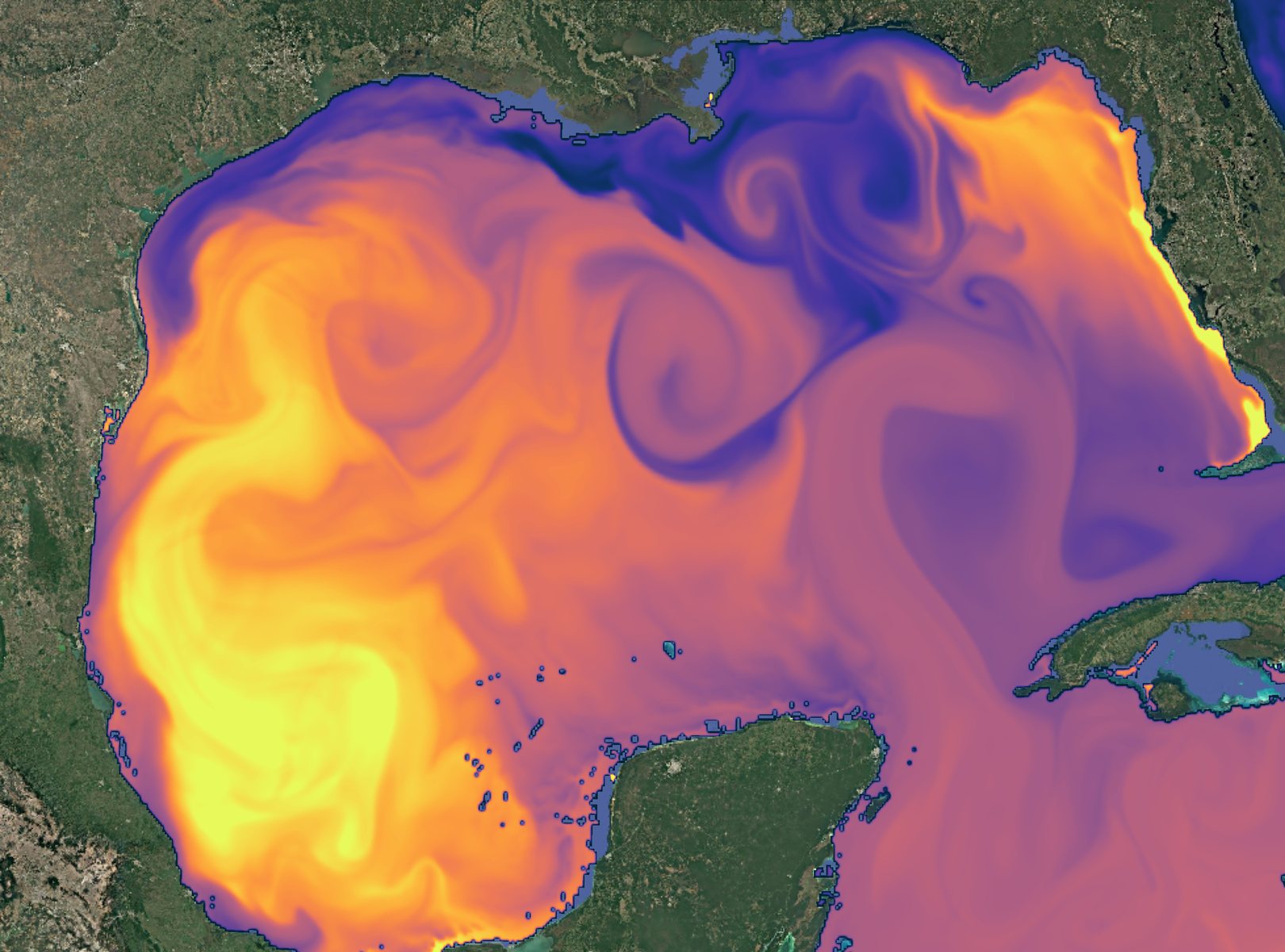
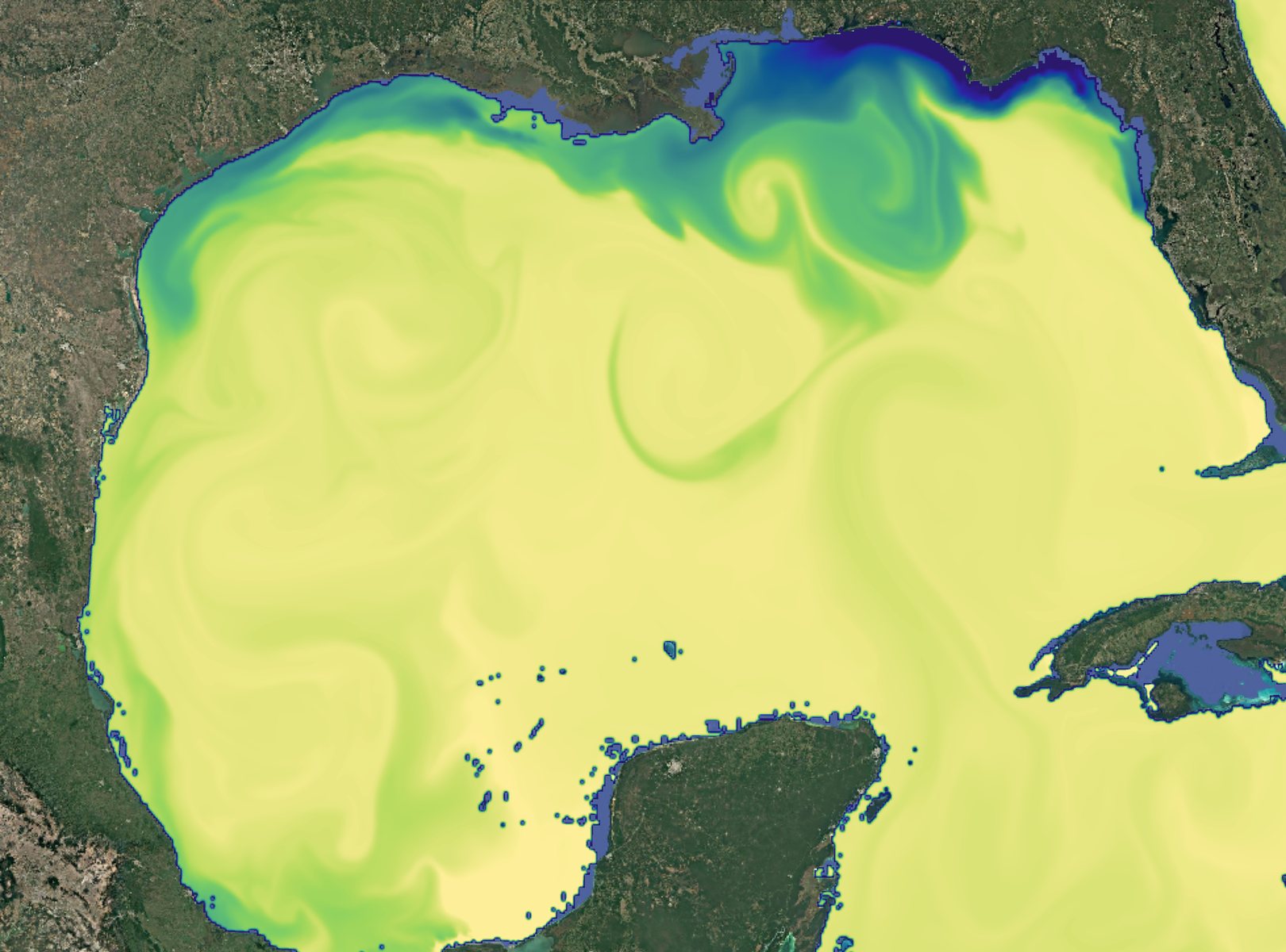
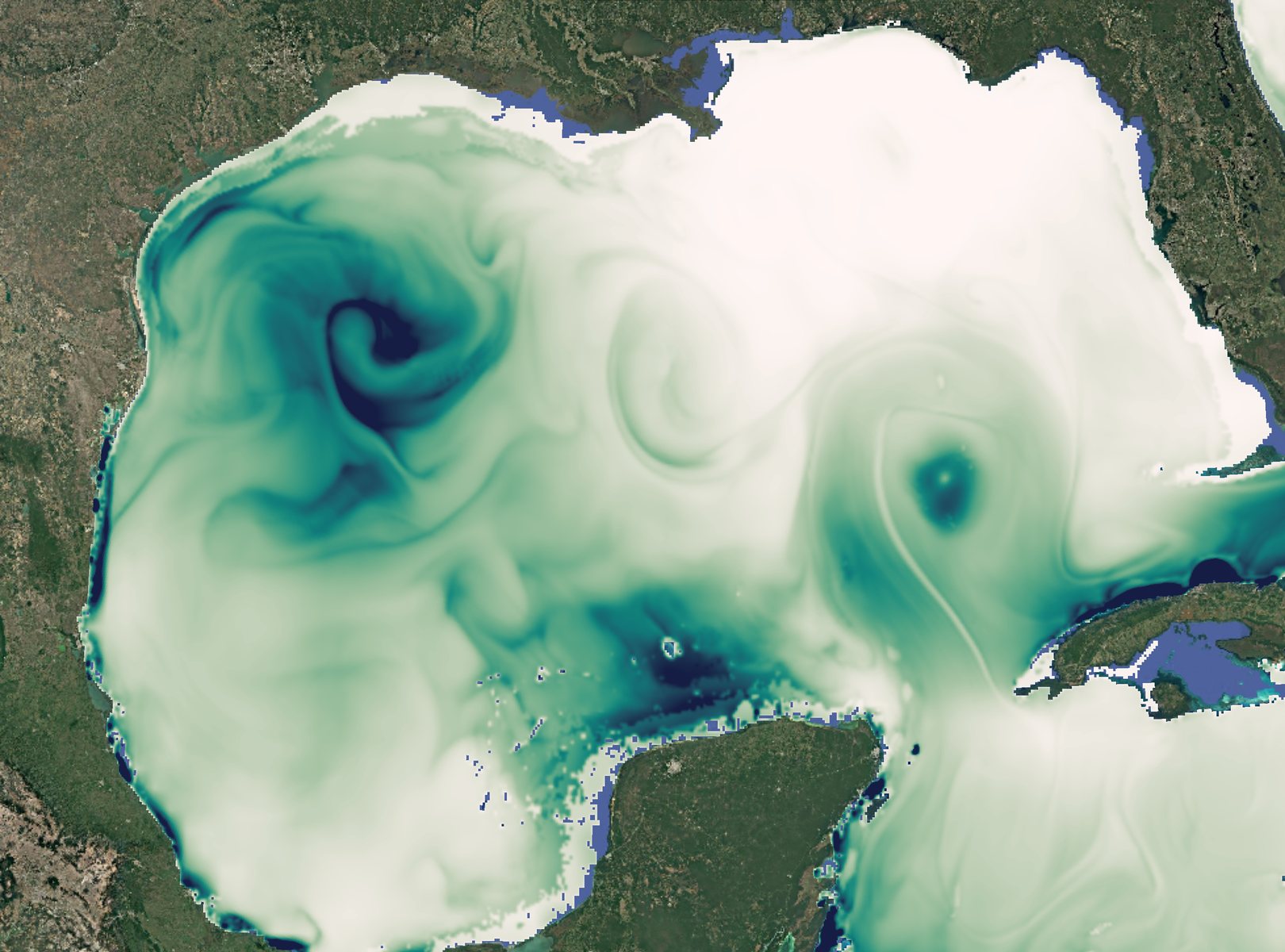
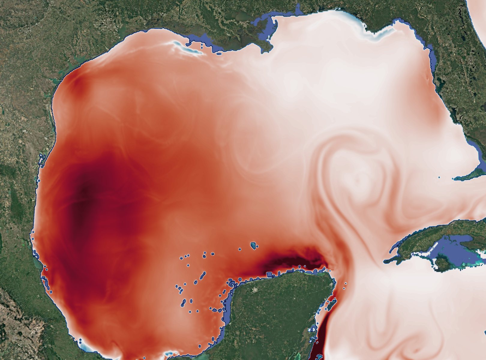
The currents matter for what they carry. These five fields come from one Gulf of Mexico simulation at a single instant: temperature, salinity, and turbulence on the physics side; air–sea CO₂ flux and dissolved carbon on the chemistry side. Same eddies, same fronts, different quantity. That coupling turns a map of currents into a carbon budget you can report.
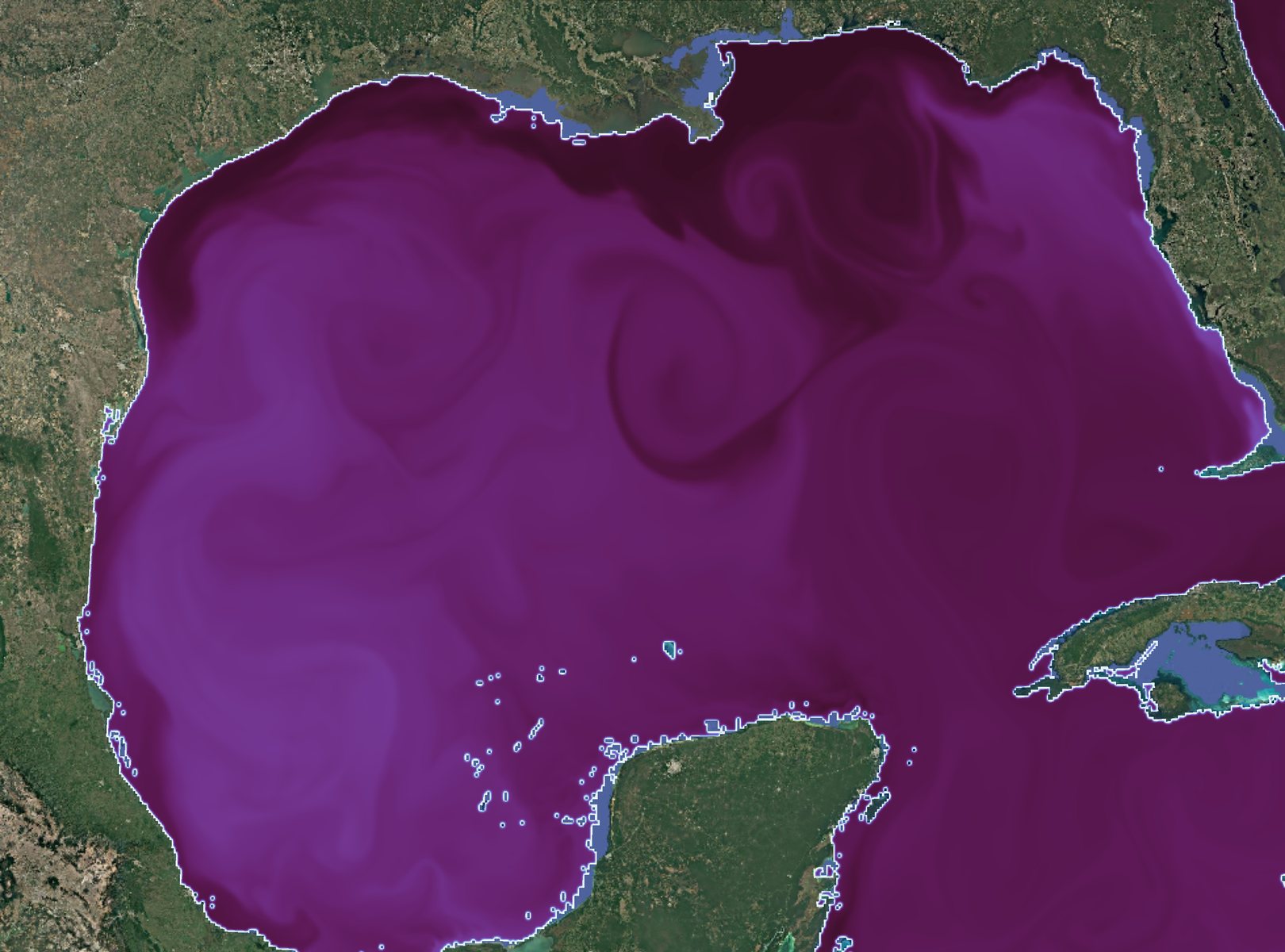
Temperature
Sea-surface temperature. Warm and cool water masses set stratification, gas solubility, and reaction rates, the physical conditions every tracer responds to.
Same water, different quantity. Circulation + chemistry, one carbon budget
06 / Validation
A model is a claim until you validate against data
A simulation is a hypothesis until you check it against reality. atdepth continuously compares the twin against real observations from buoys, ships, and satellites, and reports the skill: the error, the bias, the correlation. Uncertainty quantification is built into the digital twin.
Sweeping the model past the observations…
See it grounded in the field
Everything here is kept honest by real ocean data. See how atdepth monitors the water.