

Monitoring
In situ observations
atdepth designs, builds, and operates the instruments that keep the model validated against the ocean, with data streaming 24/7 from in-situ sensors.
Why it matters
Ocean intelligence that can scale
Conventional monitoring of human activities in the ocean leans on sparse samples, collected by hand and sent to a lab. It is slow, costly, and impossible to scale to a working operation, whether a discharge, a seabed disturbance, or a carbon-removal project.
atdepth pairs continuous, in-situ instruments with a physics-resolving model, so a handful of sensors becomes a fully resolved, three-dimensional picture of the intervention and the water around it, measured continuously and in real time.
Purpose-driven monitoring
The model decides where the sensors go
A monitoring campaign is only as good as the question it was designed to answer. Before anything is in the water, atdepth simulates the planned operation with the mechanistic model: the plume or discharge, the ocean around it, and the same ocean without it. The simulation shows where the signal will be, how strong, for how long, and where it disappears into natural variability.
The monitoring strategy is then optimized against that predicted field: the fewest instruments, placed and timed where they detect the signal and constrain the model, instead of a uniform grid that blankets the site with data no one can act on. The result is a roadmap across the project lifecycle, from baseline to trials to operations, that states what each station is for.
Stations sit where the model says the signal is detectable, not on a grid.
Sized to the objective and the budget, for validation, verification, and compliance.
atdepth's own units, your moorings and landers, or a partner's hardware, with atdepth scientists on the vessel when the trial runs.
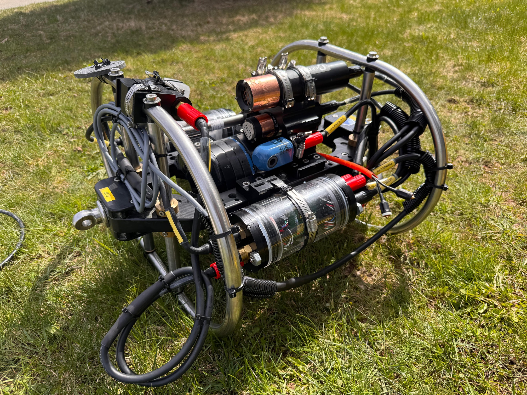
The Standard Monitoring Unit
A monitoring station built for the field
The Standard Monitoring Unit (SMU) is atdepth’s purpose-built ocean monitoring platform: currents, turbidity, pH, CO₂, oxygen, and water properties, recorded in real time and streamed back from the water. It is engineered for long-term, unattended deployment in working coastal sites, and designed to be handled by a small team, without specialist crews.
Ciona · near-field sampling · patent pending
Trustworthy numbers where the signal is
The most valuable signal sits in the near field, meters from where the measured intervention meets the ocean. It is also where ordinary sensors fail: the signal plume is turbulent and shifts within seconds, while off-the-shelf sensors can need tens of seconds to several minutes to settle. A sensor dropped straight into that plume is not measuring the intervention, it is measuring a rapidly changing sample that it cannot keep up with.
Ciona solves it by holding the ocean still. It captures a parcel of water at a known moment, seals it, and lets the sensors read a sample that isn’t changing. It then flushes and captures the next. Sensor speed stops being the limit, and every reading is tied to a specific parcel of water at a specific time.
A membrane pCO₂ sensor takes about one to four minutes to reach 63% of a step, and ten to fifteen minutes to equilibrate. Inside one such window the plume swings across most of its range, so whatever number the sensor reports is not a measurement of anything in particular.
The parcel stops changing, the sensor gets several response times against a still sample, and the reading is tied to the moment of capture. The only error left is the sensor's own.
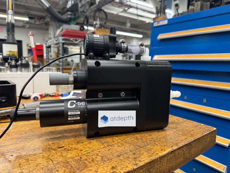
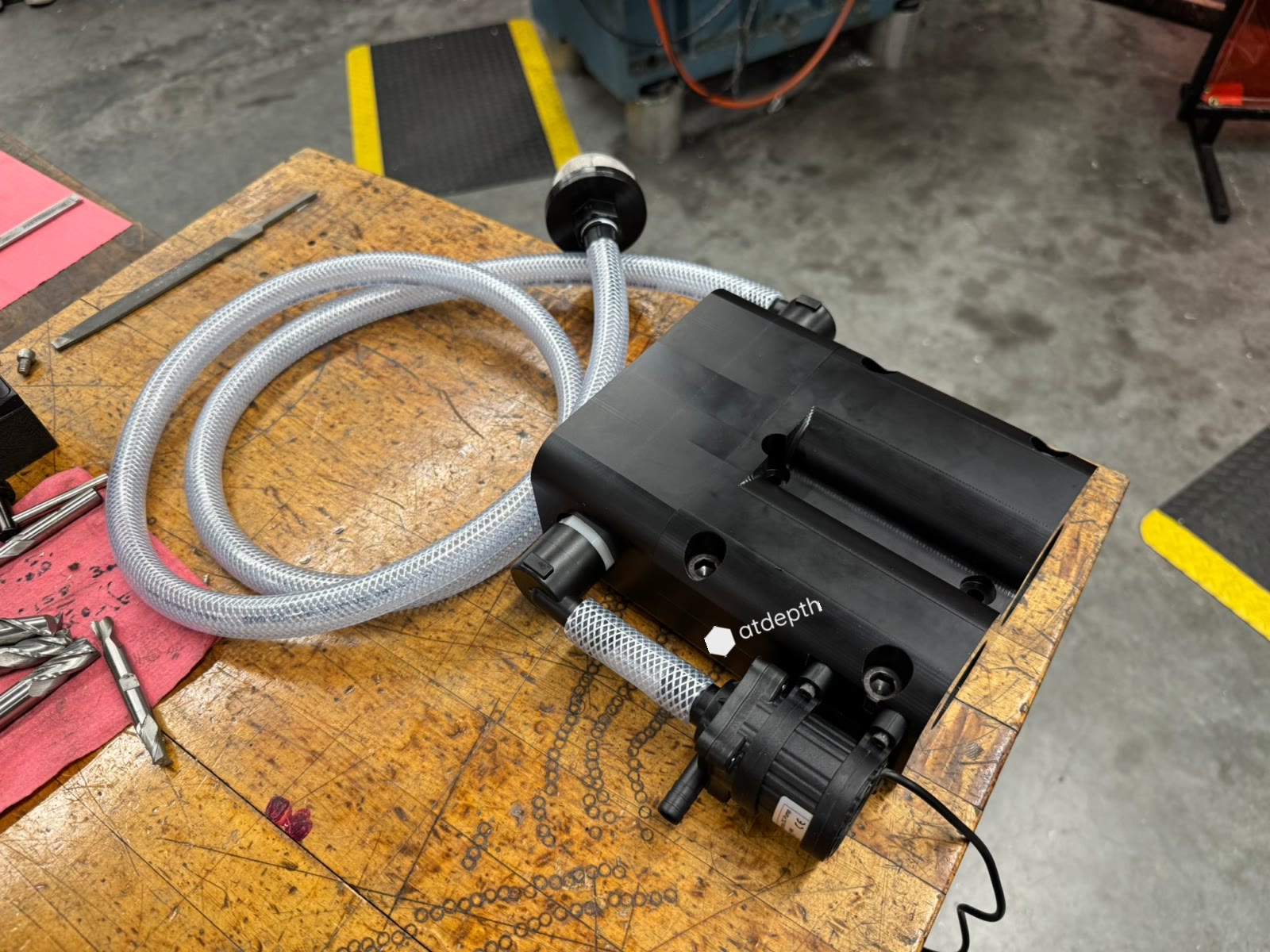
Capture
Isolate a parcel of water at a known moment.
Hold
Seal it still so the sensors equilibrate against an unchanging sample.
Read & flush
Log a measurement tied to that parcel, then draw the next.
Instead of waiting for a new kind of sensor, Ciona gives the sensors we already trust a measurement they can actually make.
Modeling + monitoring
Measurements and model, in one loop
Monitoring and modeling are delivered together. The instruments provide the observations the model is initialized with and checked against; the model fills in the water between the stations and says where the next instrument should go. Neither is sold on its own, for the same reason: sensors alone cannot bound what happens between them, and a model alone cannot be trusted where it has not been checked.
What you receive is a continuous, three-dimensional record of the water around your operation, with the skill of that record stated against the measurements: error, bias, and correlation at every station, updated as data comes in. The metrics that matter to you, a footprint against a threshold, a dilution at a boundary, a removal against a baseline, are read from that record rather than from a single point.
See how validation worksNeed real ocean data?
Tell us about your region and what you need to measure, we will tell you what a digital twin, grounded in real data, can resolve for you.